Zoom Earth serves as an advanced tool for tracking hurricanes, typhoons, and tropical cyclones in real-time, making it an essential resource for weather enthusiasts and professionals alike. As an interactive weather map of the world, Zoom Earth provides a comprehensive suite of features designed to keep you informed about various weather phenomena.
[Key Features]
Satellite Imagery: Zoom Earth delivers weather maps with near real-time satellite imagery sourced from NOAA GOES, JMA Himawari, EUMETSAT Meteosat, and NASA's polar-orbiting satellites Aqua and Terra. This allows users to visualize weather patterns across the globe with exceptional clarity.
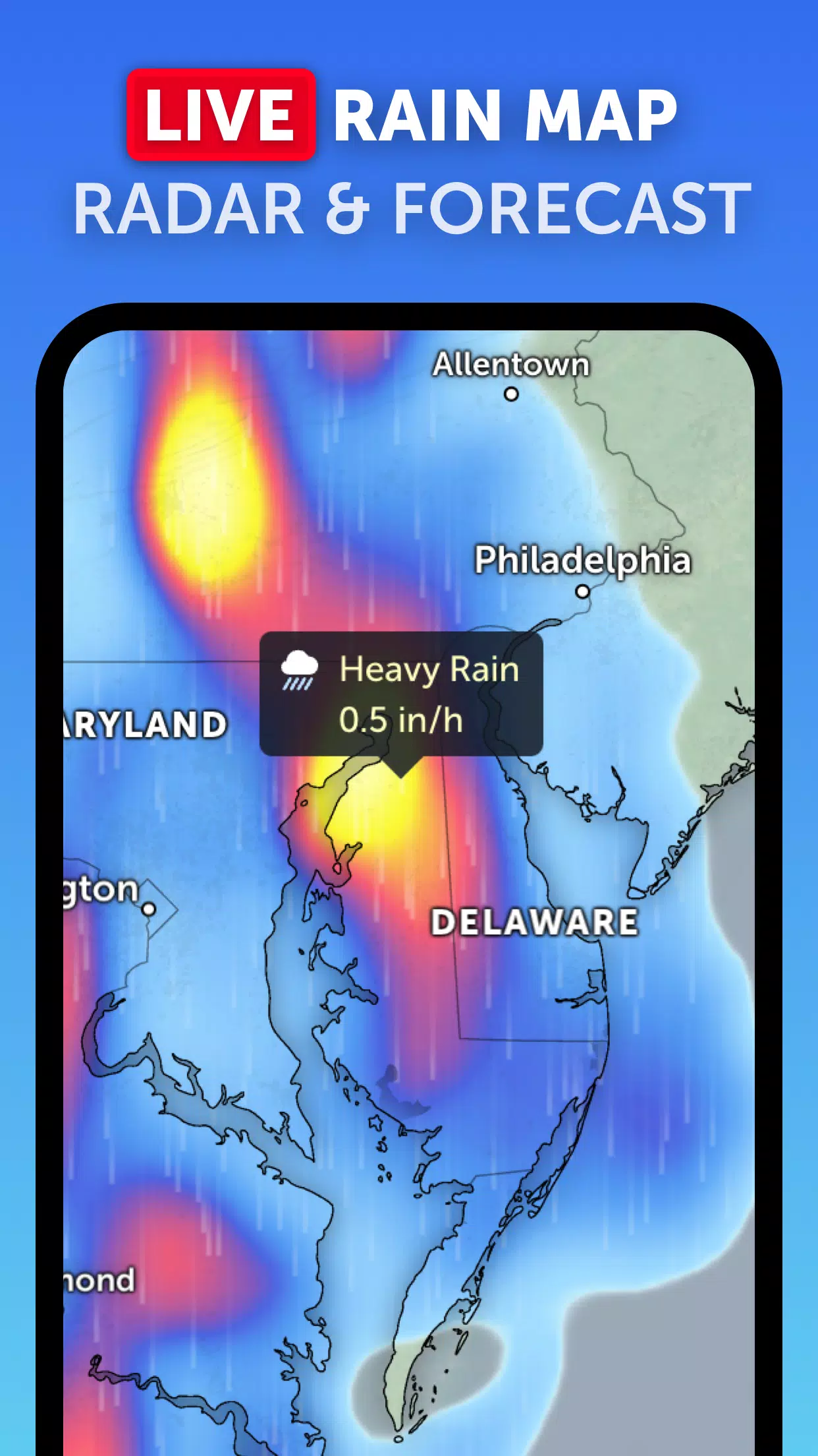
Rain Radar: Stay one step ahead of the storm with our detailed weather radar map. It displays rain and snow detected by ground-based Doppler radar in real-time, providing up-to-the-minute information on precipitation movements.
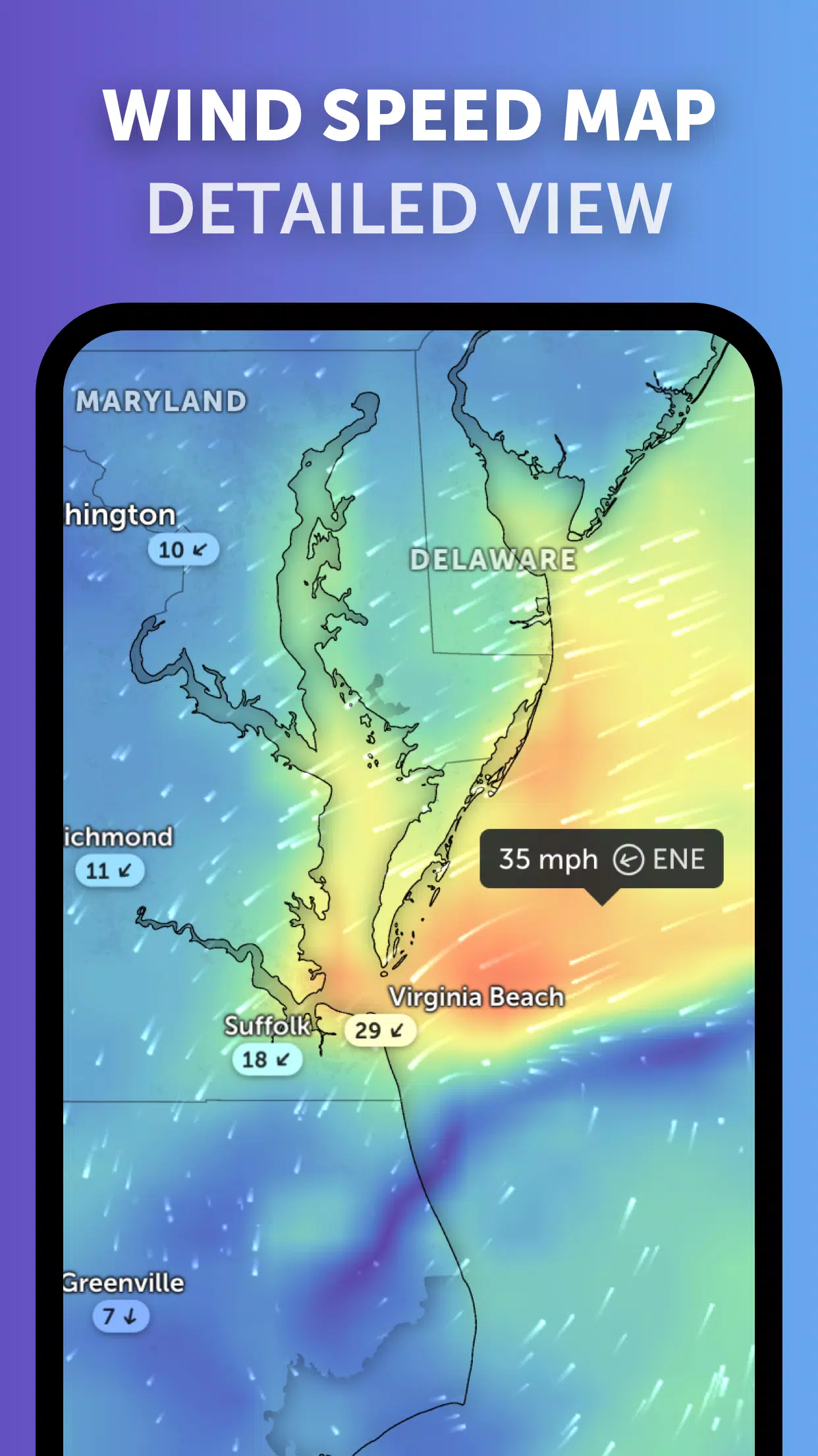
Weather Forecast Maps: Explore interactive and visually stunning global forecast maps that include precipitation, wind speed and gusts, temperature, "feels like" temperature, relative humidity, dew point, and atmospheric pressure forecasts. These maps offer a detailed overview of upcoming weather conditions.
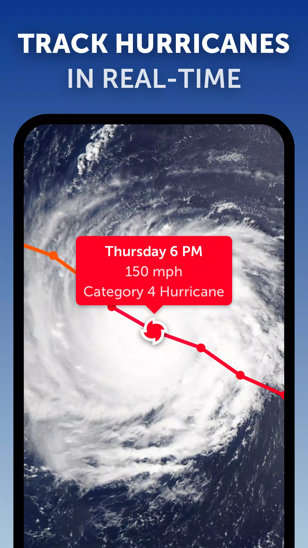
Hurricane Tracking: Track hurricanes from their development stages to category 5 status in real-time. Our tropical tracking system utilizes the latest data from NHC, JTWC, NRL, and IBTrACS, ensuring you have the most current and accurate information on tropical storms and cyclones.
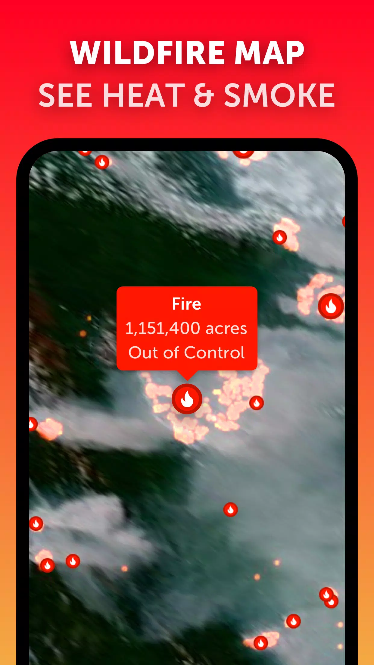
Wildfire Tracking: Monitor wildfires effectively with our active fires and heat spots overlay. This feature shows points of very high temperature detected by satellite, updated daily with data from NASA FIRMS, helping you stay informed about fire outbreaks.
Customization: Tailor your experience with comprehensive settings that allow you to adjust temperature units, wind units, time zones, animation styles, and more, ensuring that the tool meets your specific needs.
What's New in the Latest Version 3.1
Last updated on Sep 19, 2024
- Reduced clutter when viewing multiple tropical systems, enhancing user experience.
- Separate alerts for Atlantic and Eastern Pacific systems, providing clearer and more targeted notifications.
- Improvements to map labels for better readability and navigation.
With these features, Zoom Earth not only helps you track hurricanes, typhoons, and tropical cyclones but also offers a full spectrum of weather data to keep you well-informed and prepared.