Embark on your adventures with Geo Tracker, the ultimate GPS tracking app designed for those who love outdoor activities, travel, or simply need a reliable navigation tool. Whether you prefer Open Street Maps or Google, Geo Tracker integrates seamlessly to record your GPS tracks, analyze detailed statistics, and share your journeys with friends.
Geo Tracker offers a plethora of features to enhance your experience:
- Find your way back effortlessly in unfamiliar territories.
- Share your routes with friends, making it easy to collaborate or compete.
- Import routes from GPX, KML, or KMZ files to follow paths others have taken.
- Mark significant or intriguing points along your journey for future reference.
- Locate specific points on the map using known coordinates.
- Showcase your adventures with vibrant screenshots on social media.
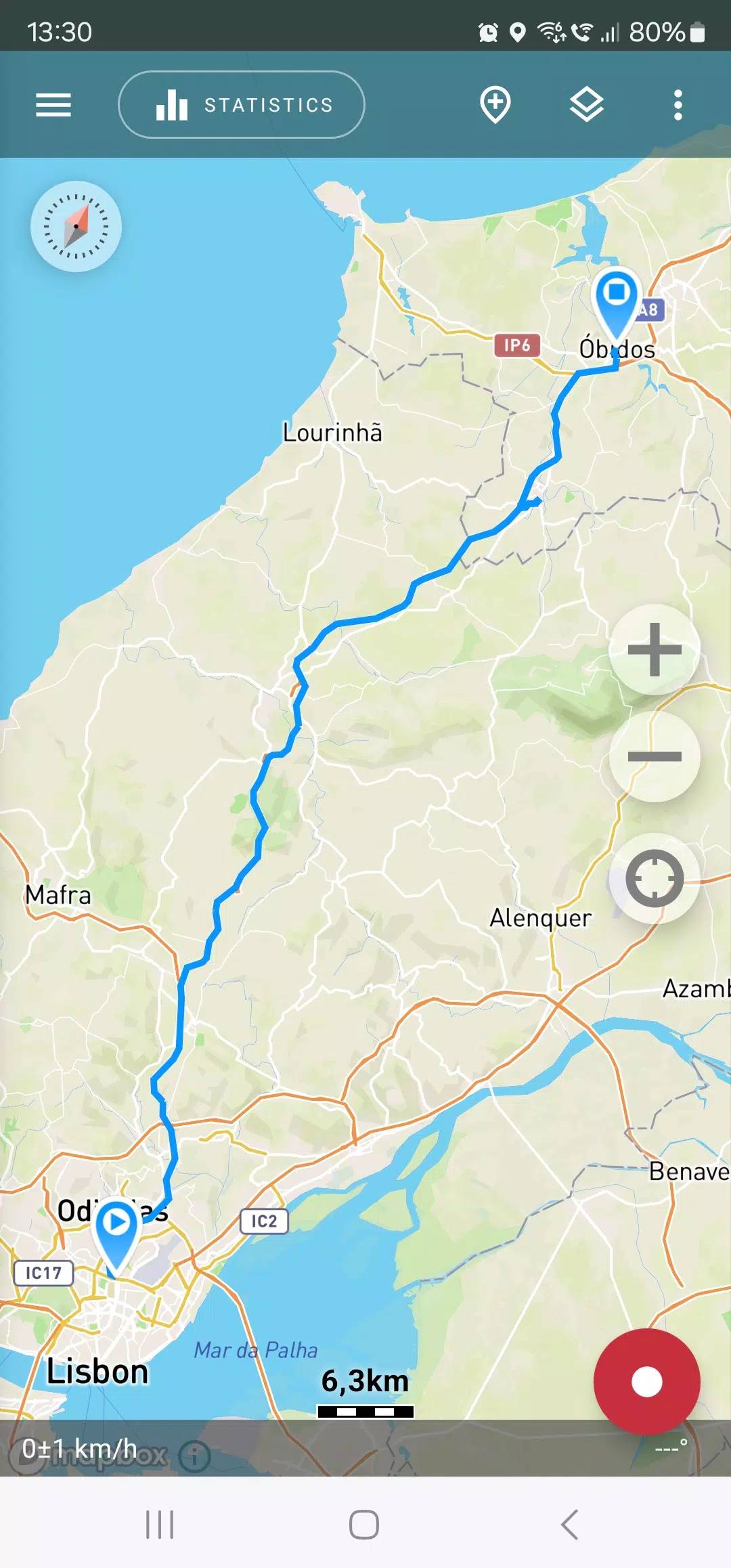
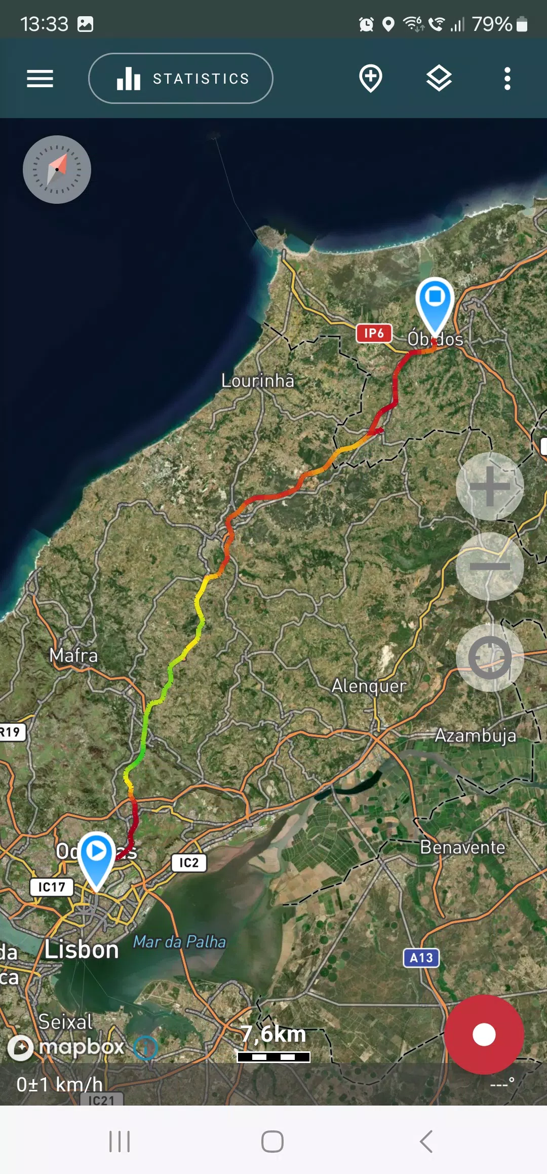
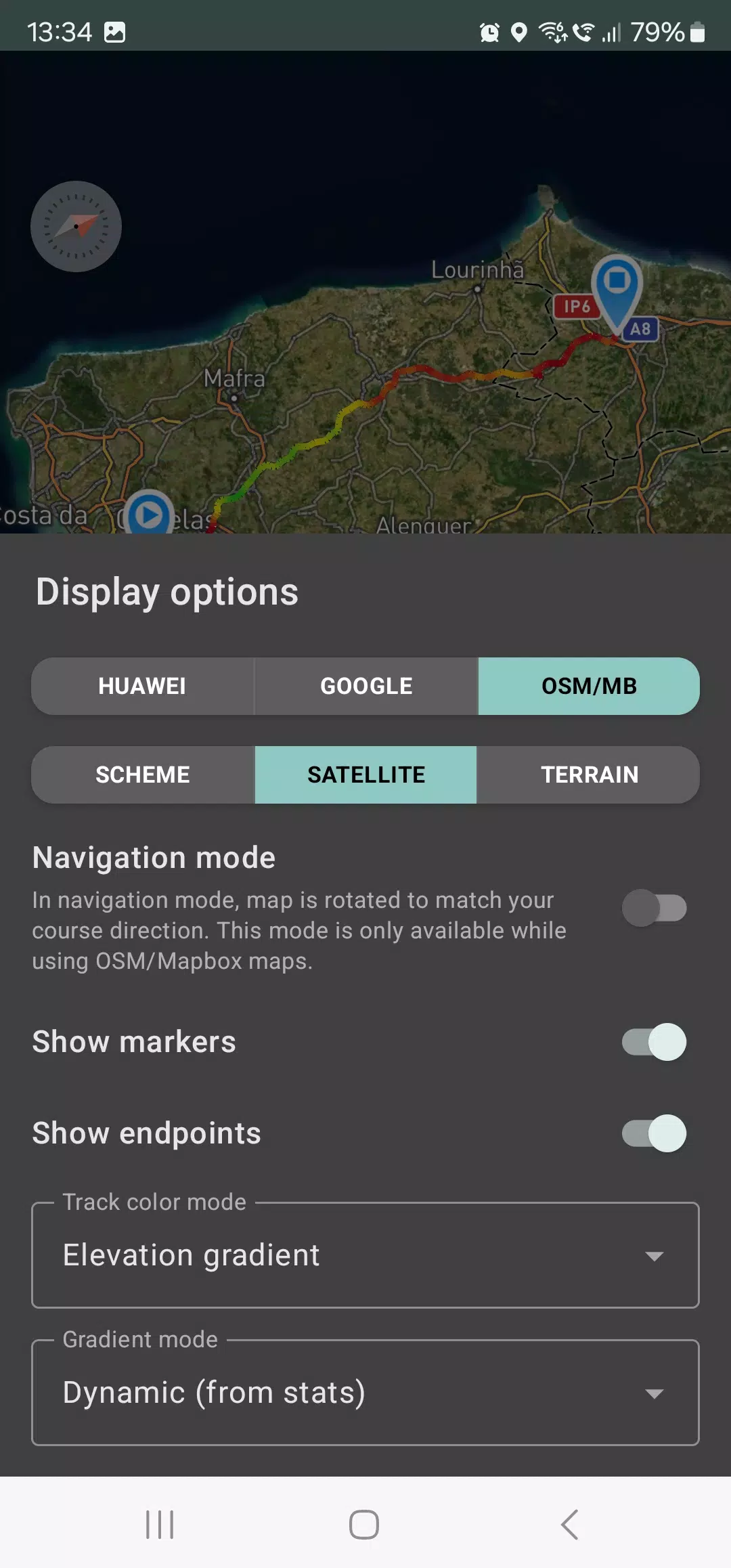
Explore your tracks and the surrounding areas within the app using detailed maps from OSM or Google, or opt for satellite imagery from Google or Mapbox. This ensures you have the most comprehensive view of your location worldwide. The maps you access are saved on your device, allowing for offline use, especially effective with OSM maps and Mapbox's satellite images. To record and analyze your tracks, only a GPS signal is necessary, with internet access required solely for downloading map images.
While driving, activate navigation mode to have the map rotate automatically with your direction of travel, making navigation more intuitive.
Geo Tracker can continue to record your tracks even when running in the background, though this may require some system configuration on your device (detailed instructions are provided in the app). The app's background mode is optimized for power efficiency, typically lasting a full day on a single charge. For even longer battery life, switch to the economy mode available in the settings.
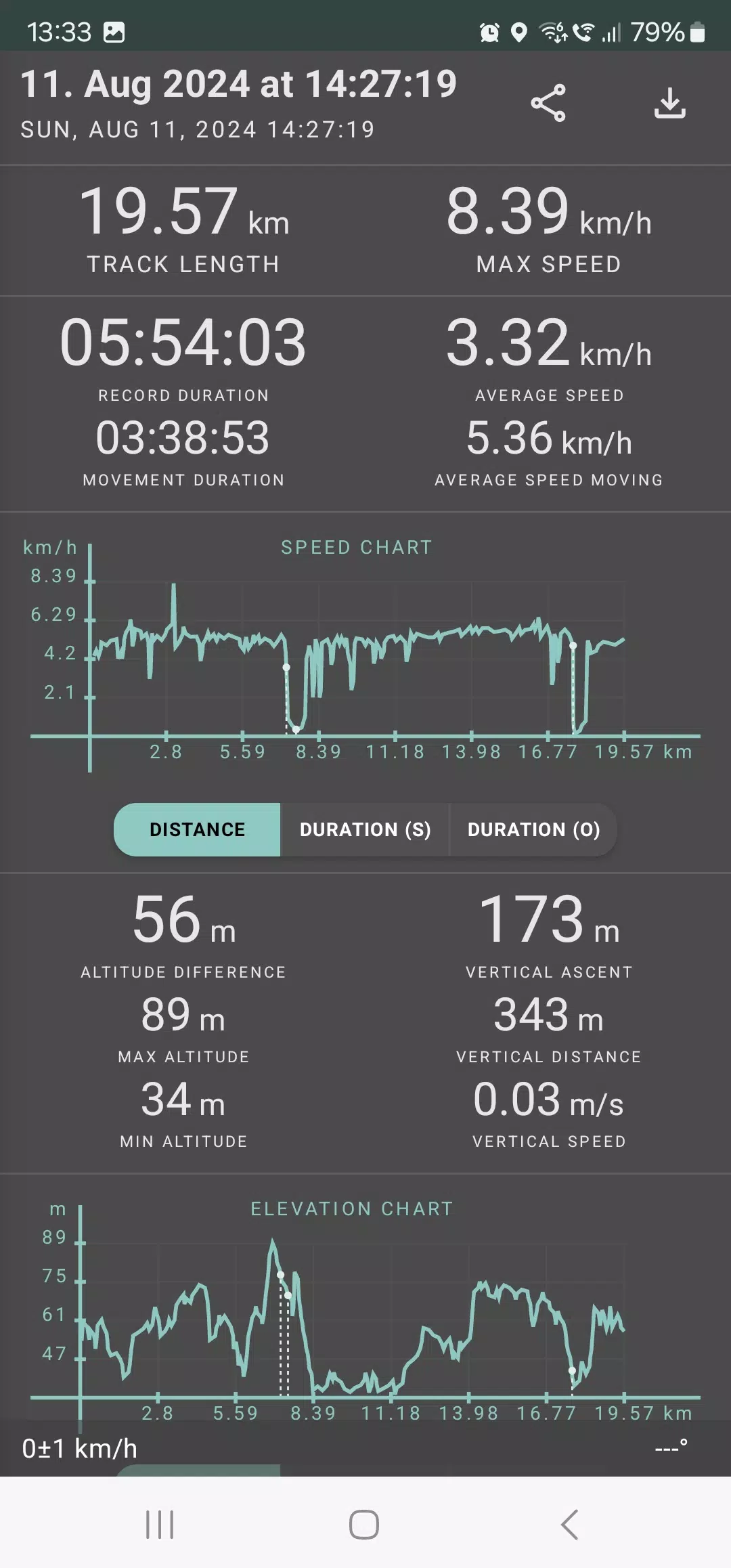
The app calculates comprehensive statistics for each track, including:
- Distance traveled and recording duration.
- Maximum and average speed on the track.
- Time and average speed while in motion.
- Minimum and maximum altitude, as well as altitude difference.
- Vertical distance, ascent, and speed.
- Minimum, maximum, and average slope.
Additionally, Geo Tracker provides detailed charts of speed and elevation data, giving you a deeper insight into your performance.
Your tracks can be saved in GPX, KML, and KMZ formats, making them compatible with popular applications like Google Earth or Ozi Explorer. Importantly, your data remains on your device and is not shared with any servers.
Geo Tracker is ad-free and respects your privacy, not collecting any personal data. If you wish to support the ongoing development of the app, you can make a voluntary donation directly within the application.
To ensure the best GPS performance, consider these tips:
- Allow some time for the GPS signal to lock on before starting your tracking.
- Restart your smartphone and ensure an unobstructed view of the sky, away from high buildings or dense forests.
- Be aware that GPS reception can be affected by weather, season, satellite positioning, and areas with poor coverage.
- Enable "Location" in your phone settings.
- Set "Date & time" to automatic in your phone settings to prevent issues caused by incorrect time zones.
- Ensure airplane mode is turned off.
If these tips do not resolve your issues, consider uninstalling and reinstalling the app. Note that Google Maps uses additional data from surrounding WLAN and mobile networks for location accuracy, which Geo Tracker does not.
For more information and solutions to common issues, visit the Geo Tracker FAQ page at https://geo-tracker.org/faq/?lang=en.